Satellites are humankind’s eyes and ears in orbit, recording and beaming back data on everything from weather to tectonic movement to where you are on your favourite running route.
According to the U.S. Strategic Command’s Joint Space Operations Centre, which detects, tracks and identifies all manmade objects in orbit, since the launch of the first satellite, Sputnik, in 1957, more than 39,000 man-made objects have been sent into orbit. Between 1972 and 1979, Canada launched five satellites, but the November 4, 1995 activation of RADARSAT-1 marked a groundbreaking new chapter in Canadian remote sensing.
In our November 1995 story about the launch, Canadian Geographic hailed RADARSAT-1’s potential to reveal vital information about the thickness and movement of ice in the Arctic. Thanks to its ability to penetrate even heavy cloud cover, RADARSAT-1 was able to produce daily Arctic ice charts, which were used to plan safe shipping routes and supply operations for offshore exploration platforms and research stations.
In January 1997, a Russian oil tanker ran aground near Japan, causing the worst oil spill in that country’s history. RADARSAT-1 images provided to Japanese authorities helped determine the extent of the spill and guide cleanup operations.
RADARSAT-1 also helped map inaccessible areas of the Amazon River Basin and produced the first seamless mosaic image of Antarctica.
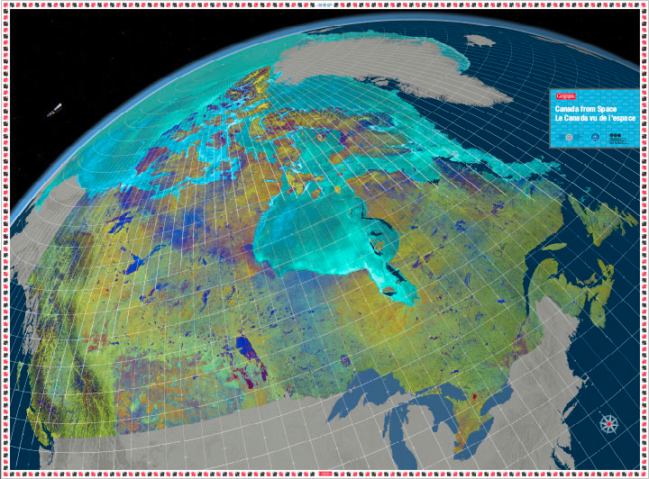
At the time it was launched, RADARSAT-1 was only expected to live for five years; it far exceeded that estimate, finally going dark on March 29, 2013. Its successor, RADARSAT-2, is still operational and produced the images used in our giant floor map of Canada as seen from space.