In Nain, Labrador, a new project is combining the ice expertise of Inuit hunters with sophisticated technology to take some of the guesswork out of ice travel in changing times. It’s also giving young people an opportunity to get involved in science.
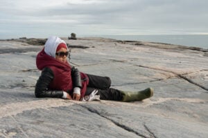
For Inuit, the sea ice is a highway, a vital link to hunting areas where they obtain much of their country food. In Nunatsiavut, the Inuit region of Labrador, people also travel over ice to collect firewood for heating their homes. They use routes their ancestors established, and which have stood the test of time — until recently.
The warmer arctic winters of recent years have brought some unpleasant surprises for Inuit, including unsafe ice in unexpected places. “The ice is thinner, it forms later and it breaks up earlier than before,” says Trevor Bell, professor of geography at Memorial University of Newfoundland. “Ice travel can be more dangerous because local knowledge of traditional routes — based on past climatic conditions — is less reliable.”
The wake-up call for Nunatsiavut came in 2009, says Bell. “That winter it rained in February (normal temperatures are around -30 C), and there was slush on the ice. Snowmobiles were getting stuck and people were falling through. Hunters couldn’t travel and so families ran short of food.” As if that weren’t enough, open water and fog prevented aircraft from landing and bringing in fresh supplies. Unable to get firewood, some people burnt furniture and their front steps to try to keep their houses warm.
Many in Nain saw that winter as a warning — a window into the future — and it spurred them into action. They teamed up with Memorial University, the Nunatsiavut Government and other organizations to look for ways to adapt. “Our goal,” says Bell, “was to find a simple and affordable method that the community could use to augment local knowledge, to identify in advance where the thin ice is so people don’t have to travel on it to find out.” The result is SmartICE, a pilot project developing the technology to do exactly that.
SmartICE uses sensors sealed in floating plastic tubes, placed in locations local hunters consider potentially dangerous. “They freeze into the ice in the fall and monitor ice thickness by measuring the difference in temperature between the air above the ice and the water below it,” explains Bell. Measurements are relayed directly to a data portal, a website where they can be retrieved by Nain-based Inuit ice specialist Joey Angnatok. Another sensor has been mounted on a qamutiik (an Inuit-style sled) so thickness measurements can be taken as it travels over the ice. “The technology is reliable and easily operated by the community,” says Bell.
SmartICE is in the prototype stage, but the ultimate goal is to produce weekly sea ice hazard maps that Inuit can use to plan their travel routes, integrating the sensor data, satellite imagery and local knowledge.
Other Arctic communities are interested. SmartICE is soon to be tested in Pond Inlet, Nunavut, where it will be operated by local research coordinator Andrew Arreak, who is being trained by Angnatok. “In the North, climate change is happening right now, and this kind of action-oriented research is needed,” says Bell. “Many young Inuit see SmartICE and are interested in being part of the science, in learning the technology. This project gives them that opportunity because it relies on local people. We’re aiming to reach communities across the North. And the knowledge needed to operate it, rather than arriving from the south, will be passed by Inuit from one community to the next.”
This is the latest in a blog series on polar issues and research presented by Canadian Geographic and Polar Knowledge Canada, a Government of Canada agency with a mandate to advance Canada’s knowledge of the Arctic and strengthen Canadian leadership in polar science and technology. Learn more at
canada.ca/en/polar-knowledge.