
Science & Tech
20 Canadian innovations you should know about
Celebrating Canadian Innovation Week 2023 by spotlighting the people and organizations designing a better future
- 3327 words
- 14 minutes
This article is over 5 years old and may contain outdated information.
Mapping

by Aaron Brindle, Google Canada
Today, Canada’s capital opens its doors to Google Maps. From the floor of the House of Commons and the Red Chamber of the Senate, to the Library of Parliament and the Prime Minister’s Office, the Street View Trolley is making its way through the hallowed halls of Parliament, mapping this iconic landmark of Canadian history and culture for all Canadians to enjoy and explore.


Through the main doors of Parliament, Google Maps users will be able to virtually walk down the Hall of Honour, visit the Memorial Chamber and take the elevator to the top of the Peace Tower. Or, hang a left in Confederation Hall and stroll past portraits of Canada’s former prime ministers to the foyer of the House of Commons, where the media scrum MPs and ministers before going into the House.
Parliament stands at the heart of our democracy. Through these images, people across the world will be able to see the places where our laws are debated and the chambers where senators and MPs come together to represent every Canadian. Users will have behind-the-scenes access to tour working offices and explore the iconic art, architecture and history of an institution that serves as the backdrop for Canadian politics.


We appreciate the support of the Offices of the Prime Minister of Canada, the Speaker of the House of Commons, the Speaker of the Senate of Canada and the Library of Parliament, all of whom made this project possible.
Stay tuned for the launch of the Parliament Hill imagery in Google Maps in the coming months!
About Street View and the Trolley
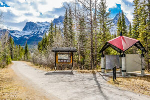
Google Maps and Street View lets you explore places around the world through 360-degree street-level imagery, offering you the opportunity to virtually travel the streets of Toronto, the ski slopes of Whistler, British Columbia, and the chilly tundra of Canada’s Arctic.
To take Street View technology indoors, we developed a small push-cart, lovingly dubbed Trolley. It has been used in places such as galleries and museums with minimal disruption and ensuring the safety of all exhibits. The Trolley is outfitted with a few components that are key to collecting indoor imagery: a panoramic camera to collect 360-degree views, motion sensors to track Trolley’s position, a hard drive to store data, and an onboard computer to operate the system. With this adapted equipment, we were able to gather imagery and bring it into Google Maps. You can now drag “Pegman” directly onto fascinating places like the Metropolitan Museum of Art in New York City and the White House.
Aside from Parliament Hill, Canadians will soon have the opportunity to visit the interiors of other Canadian landmarks, from Calgary’s Saddledome and BC Place, to the historic battlements of Quebec City and Toronto’s Royal Ontario Museum.
Are you passionate about Canadian geography?
You can support Canadian Geographic in 3 ways:
Science & Tech
Celebrating Canadian Innovation Week 2023 by spotlighting the people and organizations designing a better future

Mapping
A new update allows users to view 3,100 Indigenous communities and treaty settlement lands

People & Culture
The history behind the Dundas name change and how Canadians are reckoning with place name changes across the country — from streets to provinces
Travel
The trail started with a vision to link Canada coast to coast to coast. Now fully connected, it’s charting an ambitious course for the future.