Mapping
Découvrir Nuna, notre terre
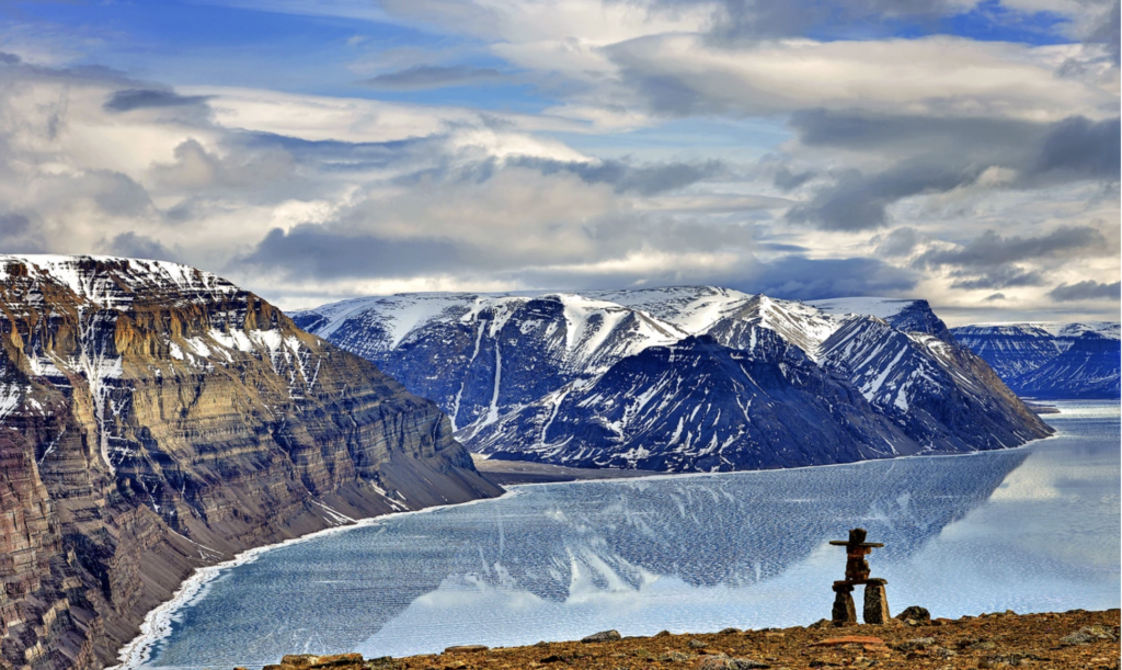
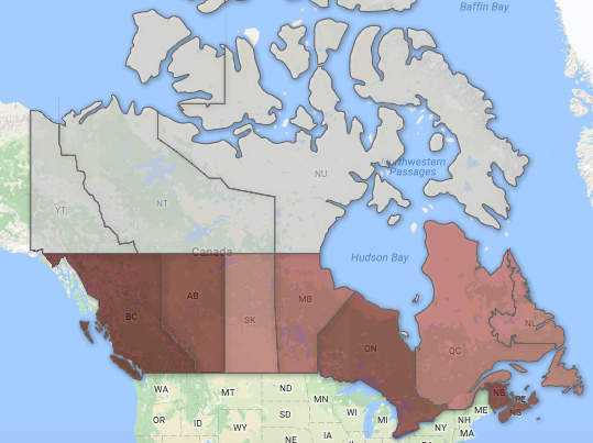
Alors qu’on célébrera les 25 ans d’existence du Nunavut, les Inuits demandent de pouvoir décider de leur avenir.
- 676 words
- 3 minutes
Mapping
Alors qu’on célébrera les 25 ans d’existence du Nunavut, les Inuits demandent de pouvoir décider de leur avenir.
Mapping
ᓄᓇᕗᑦ 25-ᕈᖅᑎᓪᓗᒍ, ᑕᐃᓯᔪᑦ ᐃᓄᐃᑦ ᐃᒻᒥᓂ ᐊᐅᓚᔪᓐᓇᓂᕐᒧᑦ ᓯᕗᓂᔅᓴᒥ ᓄᓇᕗᒻᒥ
Mapping
As the territory turns 25, a call for an Inuit self-determined future in Nunavut
Mapping
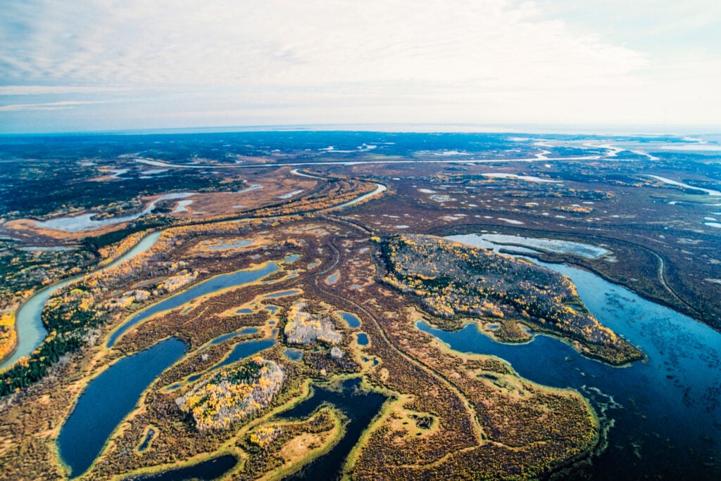
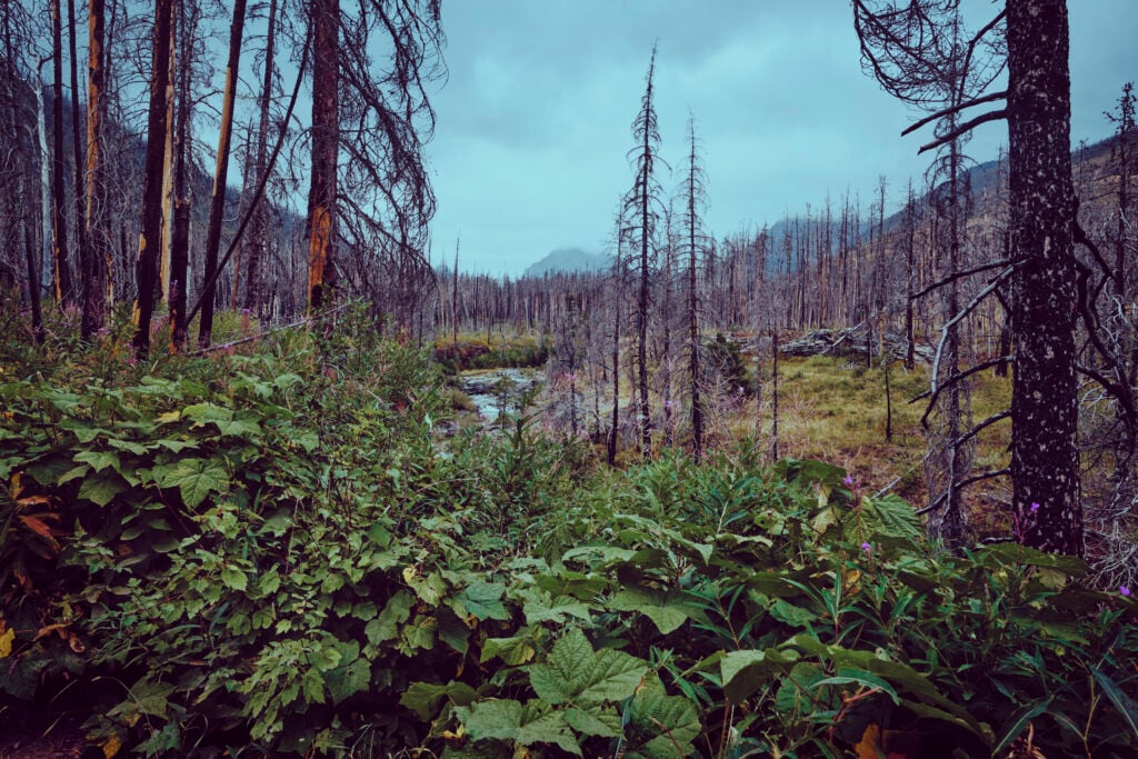
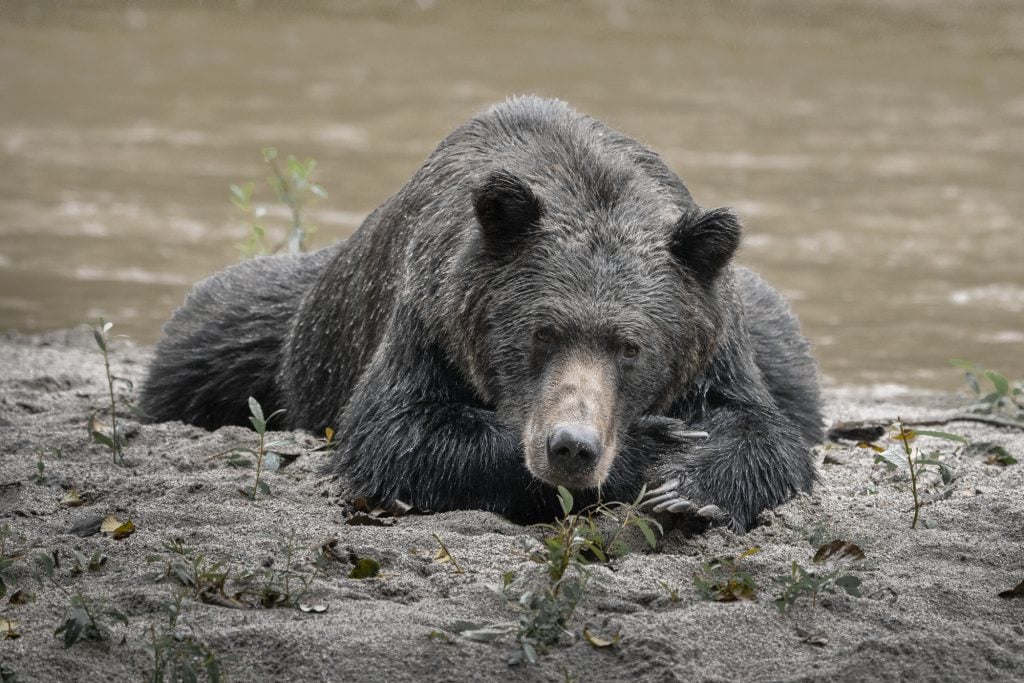
While most of the delta lies within the federally protected Wood Buffalo National Park, activity outside the park could threaten its future

Mapping
Blacklegged ticks are spreading across Canada — and they’re bringing Lyme disease with them
Mapping
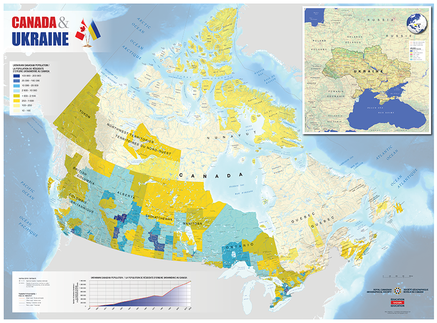
Map shows the distribution of people of Ukrainian descent across Canada, highlighting the deep connection between the two countries
Mapping
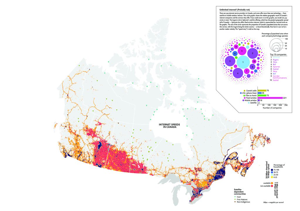
How Canada’s rural-urban internet divide determines which communities can tap into an efficient internet network
Mapping
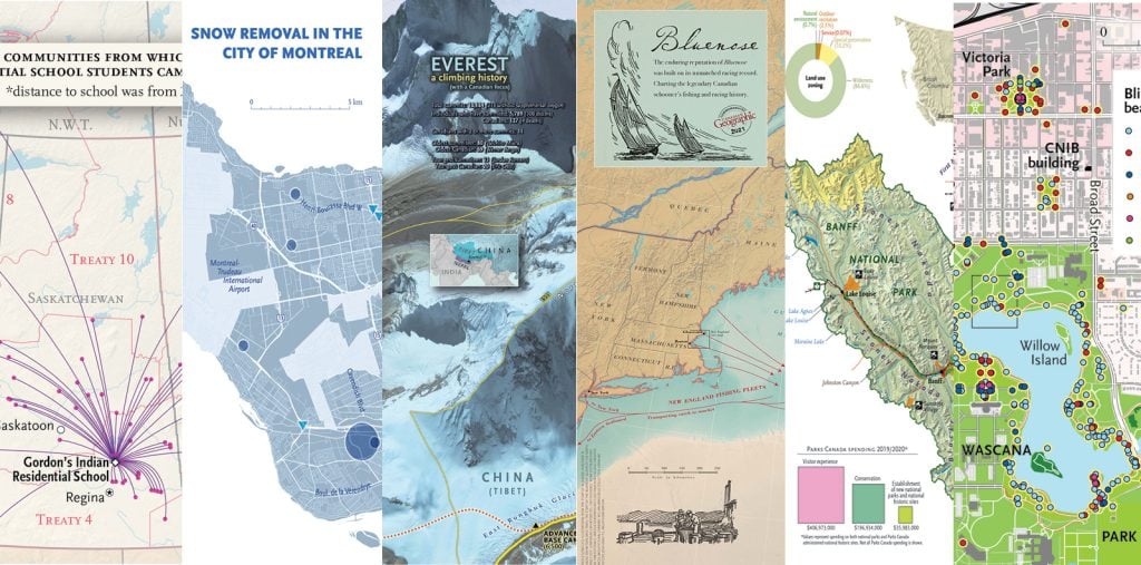
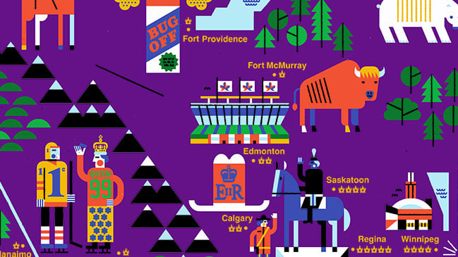
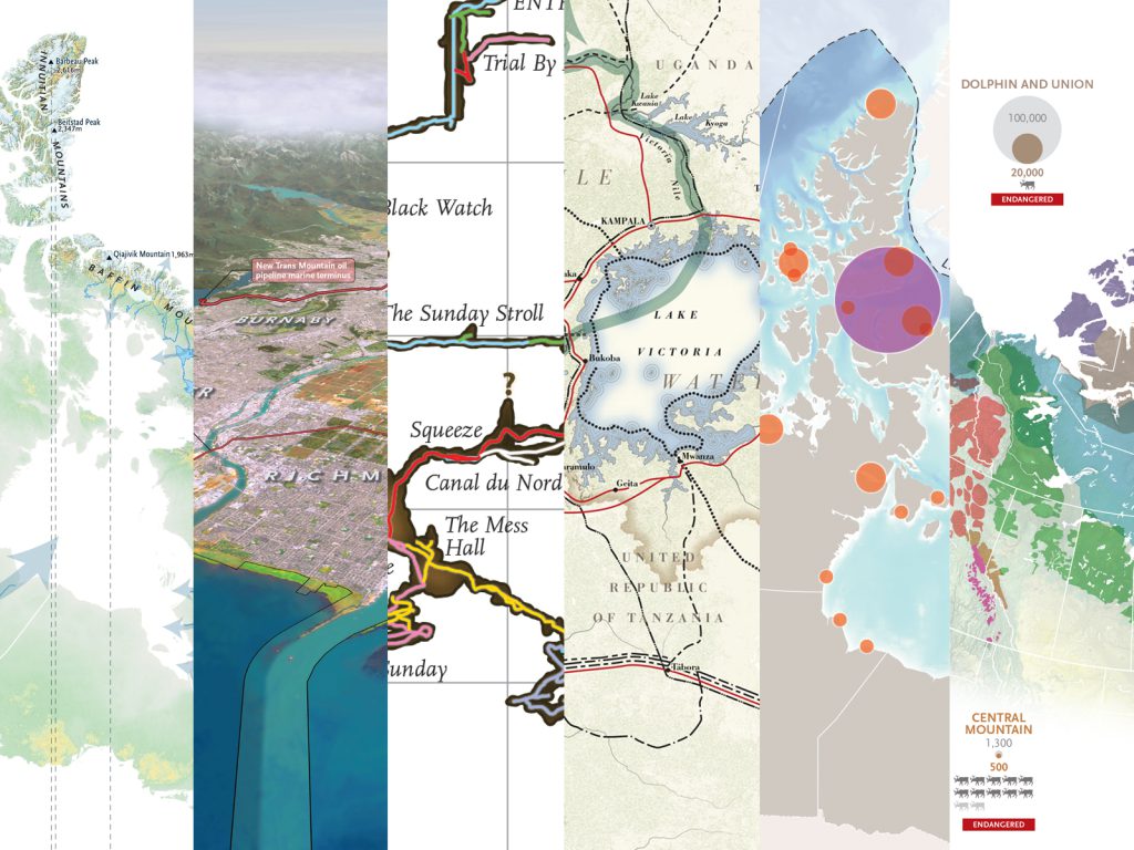
Cartographic highlights from Canadian Geographic’s 2021 issues
Mapping
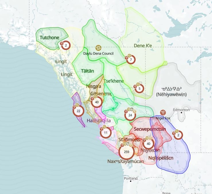
The 18-layer First Peoples’ map of B.C. focuses on language, art and heritage
Mapping
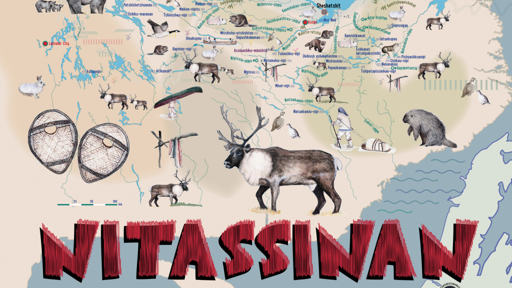
An Innu school board has created a map to pass on intergenerational knowledge to schoolchildren
Mapping
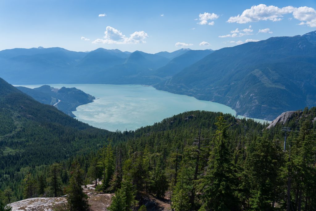
The 400-layer map will connect communities, celebrate culture and share data to protect the Howe Sound ecosystem
Mapping
Users can learn about the Indigenous territories, languages and treaties of the cities they live in with just a few clicks
Mapping
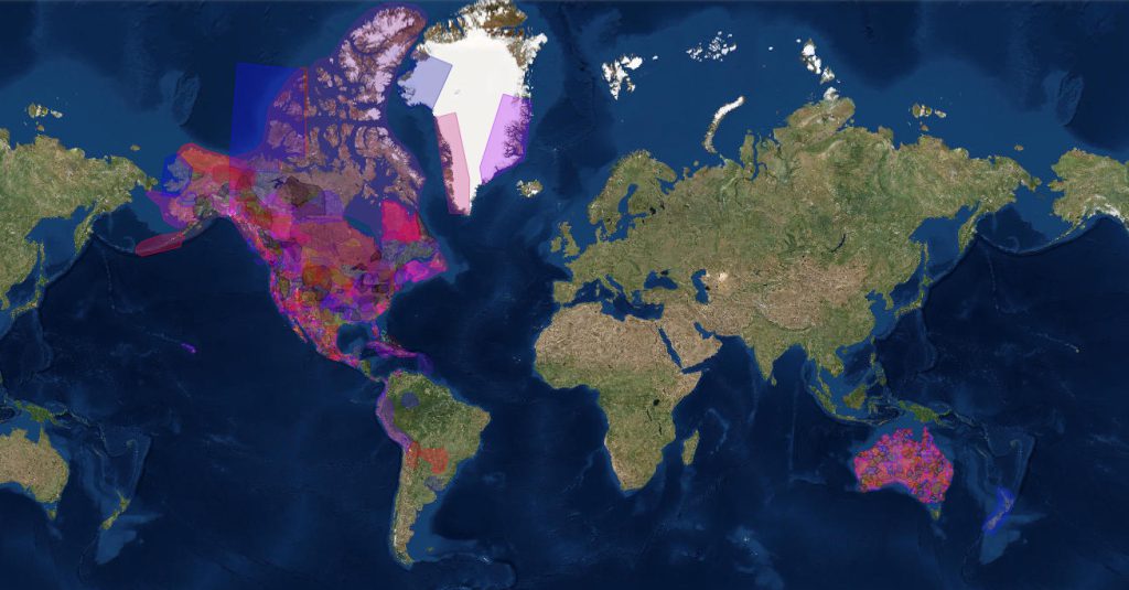
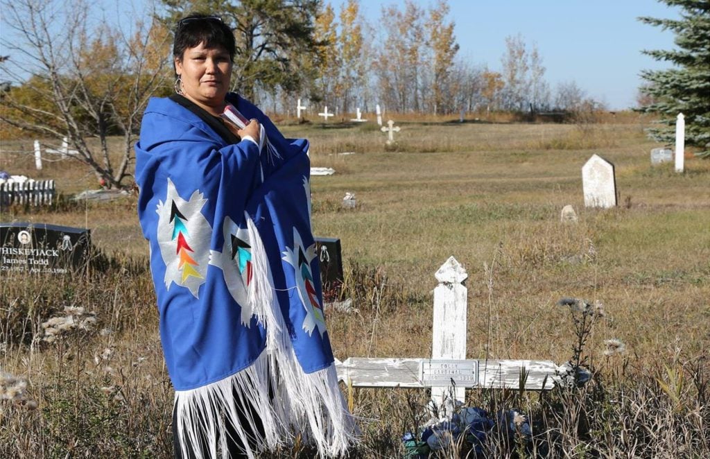
Indigenous rights activist and 60s Scoop survivor Colleen Cardinal discusses her project to map the Indigenous adoptee diaspora
Mapping
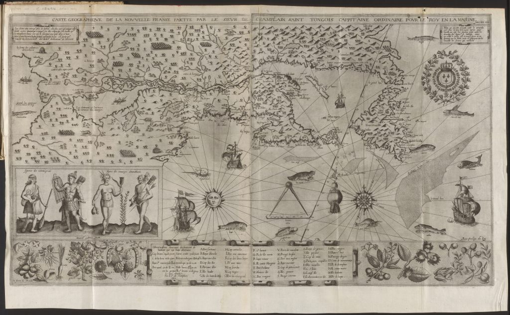
Although often unheralded in accounts of Champlain's accomplishments, Indigenous Peoples played an important role in helping the famous explorer map New France
Mapping
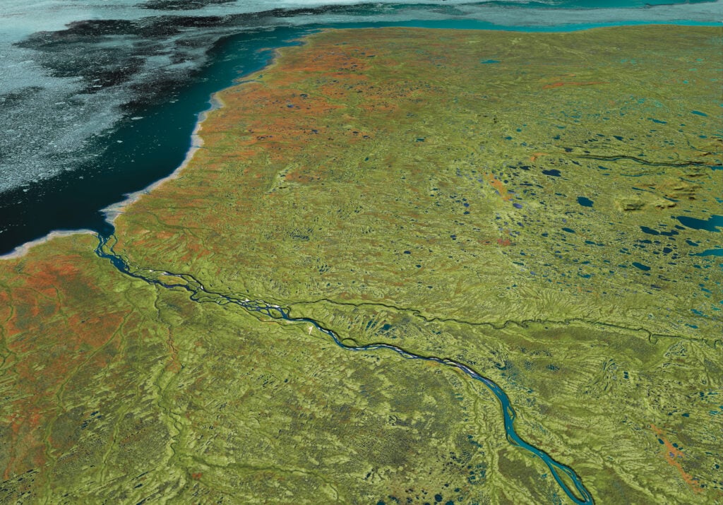
Canadian Geographic’s cartographer explores the many facets of the Hudson Bay Lowlands, one of the world’s most significant wetlands
Mapping
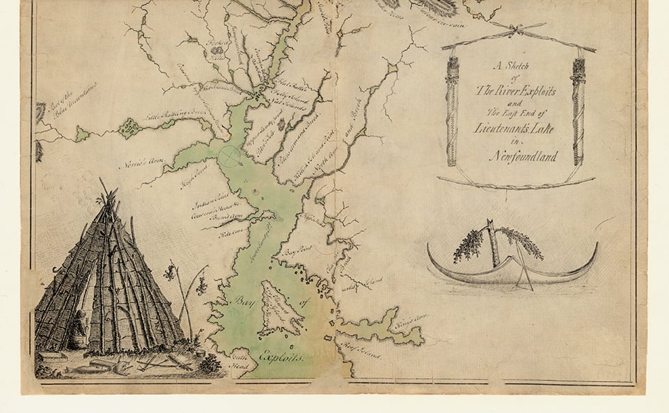
This map, “taken on the spot in the year 1768,” tells but a tiny piece of the story of Newfoundland’s bygone Beothuk
Mapping
Cartographic highlights from Canadian Geographic’s 2020 issues
Mapping
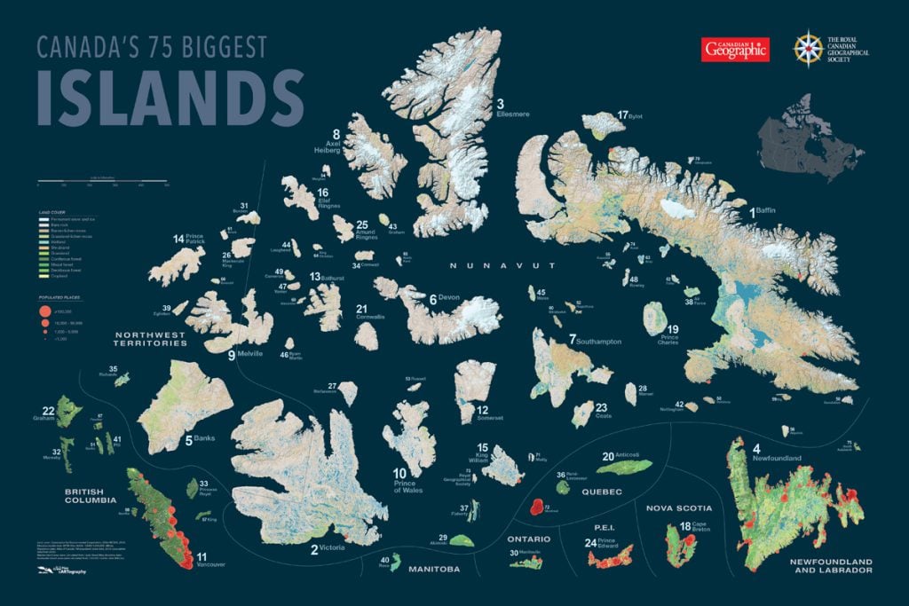
Canadian Geographic's cartographer Chris Brackley shares insights into his process in charting the country's largest islands for an exclusive wall map
Mapping
Cartographic highlights from Canadian Geographic’s 2019 issues
Mapping
Mapping
Mapping
Mapping
Mapping
Mapping
Mapping
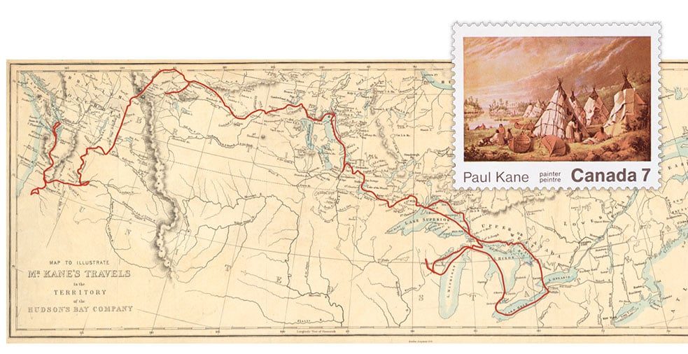
The legacy of artist Paul Kane‘s epic 19th-century journey across Canada
Mapping
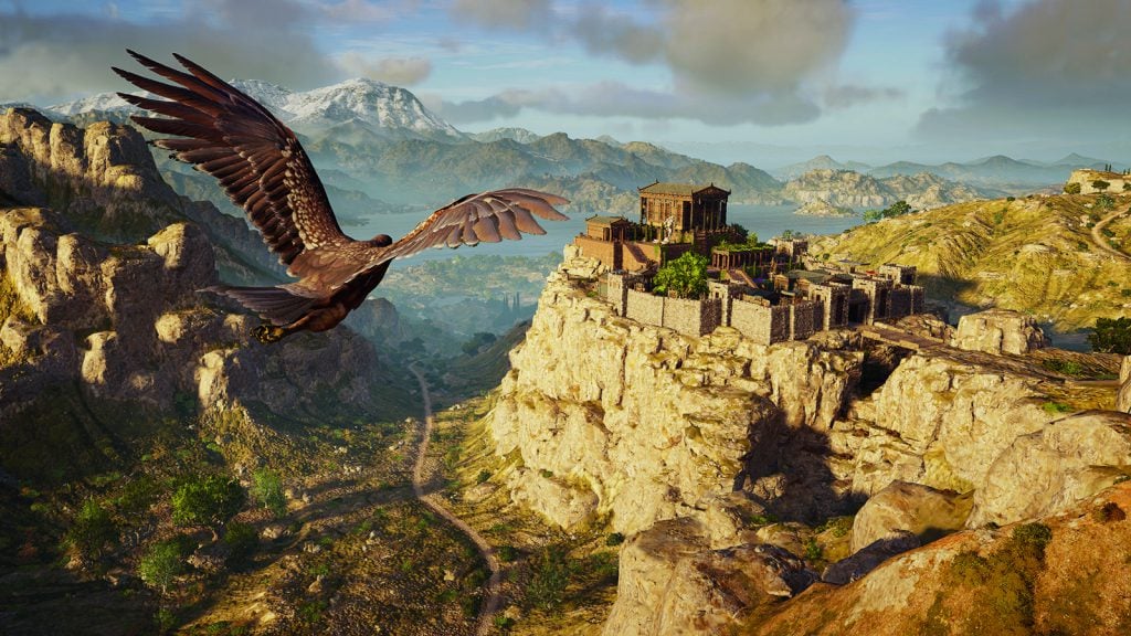
Maps have long played a critical role in video games, whether as the main user interface, a reference guide, or both. As games become more sophisticated, so too does the cartography that underpins them.
Mapping
How a divisive political battle put Newfoundland on the map
Mapping
Inside the campaign to make the Earth spherical again
Mapping
A bountiful cod industry is pictured on a 1920s map. Decades later, a moratorium would change everything.

Mapping
Marine protected areas are widely considered to be an effective tool for ocean conservation. But are they living up to their full potential?
Mapping
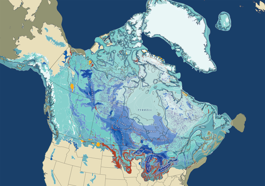
North America was created by ice, and its legacy covers the landscape

Mapping
Phase One of Trans Canada Trail accessibility mapping project complete thanks to para athletic power
Mapping
Four Canadian map entries have been recognized by the Cartography and Geographic Information Society in the 2020 Map Design Competition
Mapping
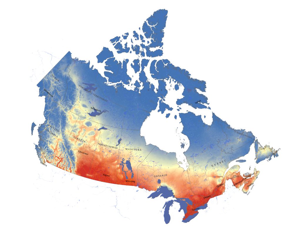
The Climate Atlas of Canada shows users what trends to expect in their communities as a result of climate change
Mapping
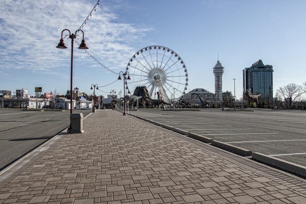
Niagara Falls is Canada's can't-miss attraction, according to TripAdvisor U.K. users
Mapping
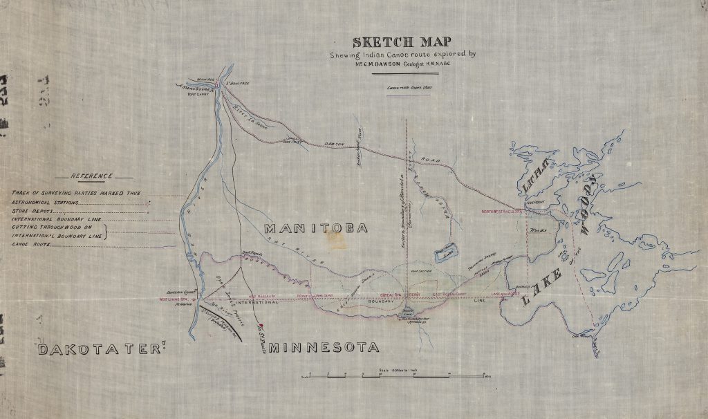
How George Dawson’s seminal work for the British North American Boundary Commission did far more than simply mark the 49th parallel
Mapping
A case decided this week by the Supreme Court of British Columbia was, in essence, all about geography
Mapping
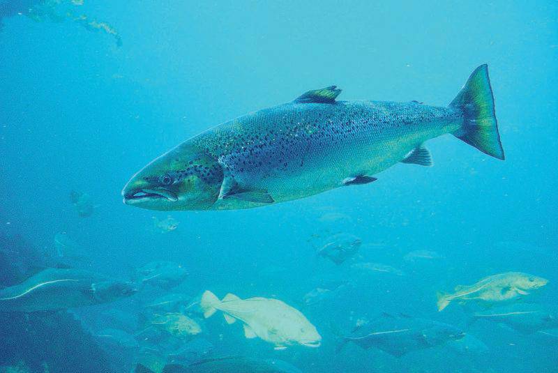
Groups protecting Atlantic salmon spawning grounds on Canada’s East Coast have a new view of the problems facing the prized species
Mapping
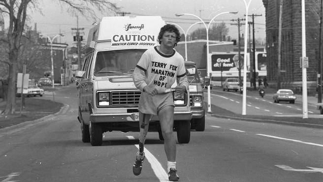
April 2020 marks 40 years since Terry Fox’s monumental Marathon of Hope
Mapping
Cartographic highlights from Canadian Geographic's 2017 issues and special publications
Mapping
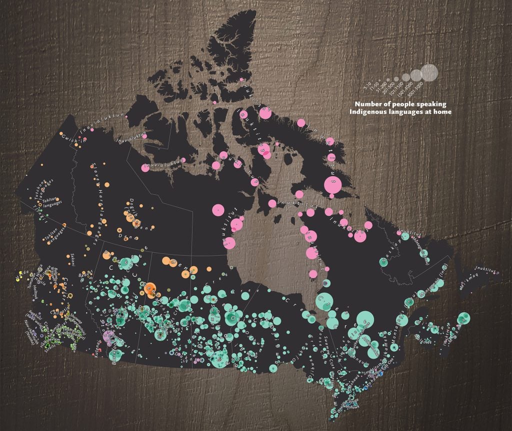
See where 60 languages belonging to 12 language families are being used right now
Mapping
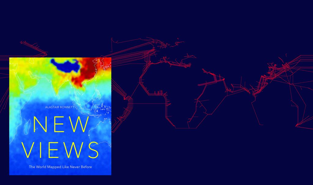
In his new book, social geographer Alastair Bonnett promises 50 maps unlike any you've ever seen. Here's a look at six of our favourites.
Mapping
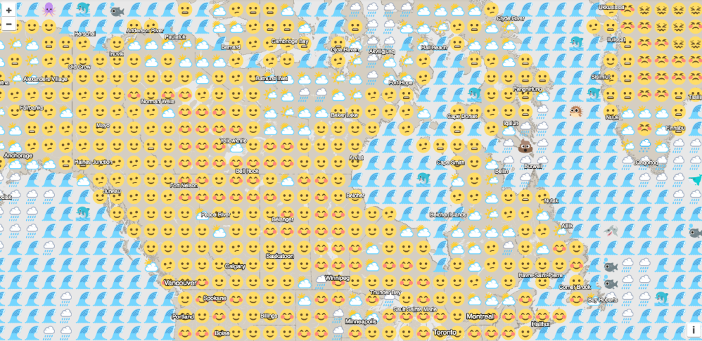
Today's weather: smiley with a chance of umbrellas
Mapping
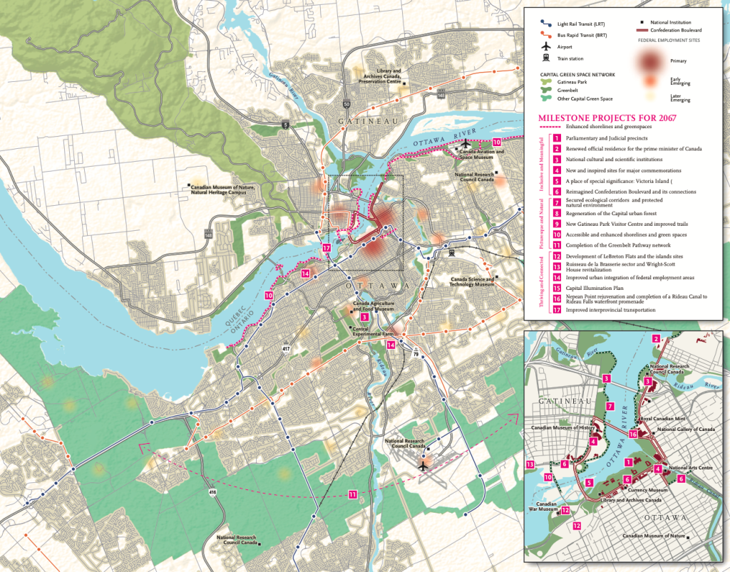
As Canada celebrates its 150th anniversary, the National Capital Commission is helping to plan how Ottawa will evolve over the next half-century
Mapping
How Canadians went from fighting Germans in Europe to battling Bolsheviks in Russia after the First World War
Mapping
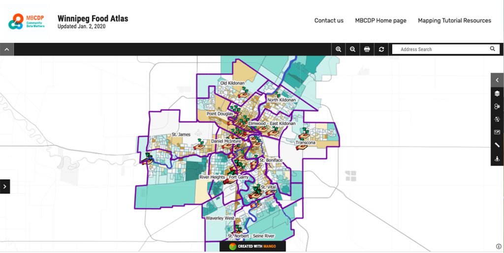
The interactive map is helping local health authorities see the city differently, including charting diabetes neighbourhood by neighbourhood
Mapping
Cartographic highlights from Canadian Geographic’s 2018 issues
Mapping
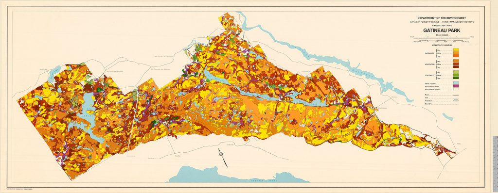
This colourful forest-cover map, completed in 1974, provided invaluable information for the management of the National Capital Region’s cherished park
Mapping
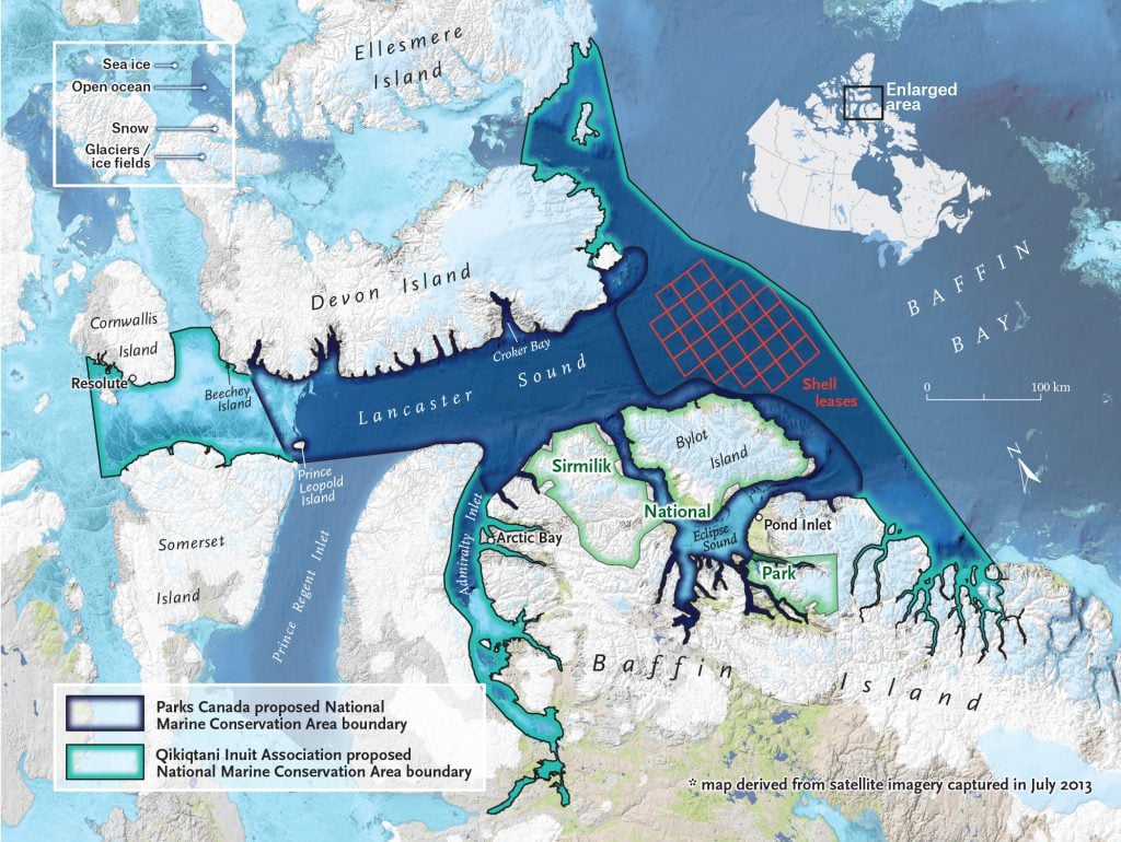
Two visions of the landmark proposed marine protected region
Mapping
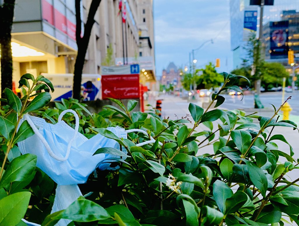
The mismanagement of personal protective equipment waste is contributing to environmental degradation

Mapping
While we struggle to implement coordinated responses to the COVID-19 pandemic, many species show extreme commitment to preventing the spread of disease — and even sacrifice
Mapping
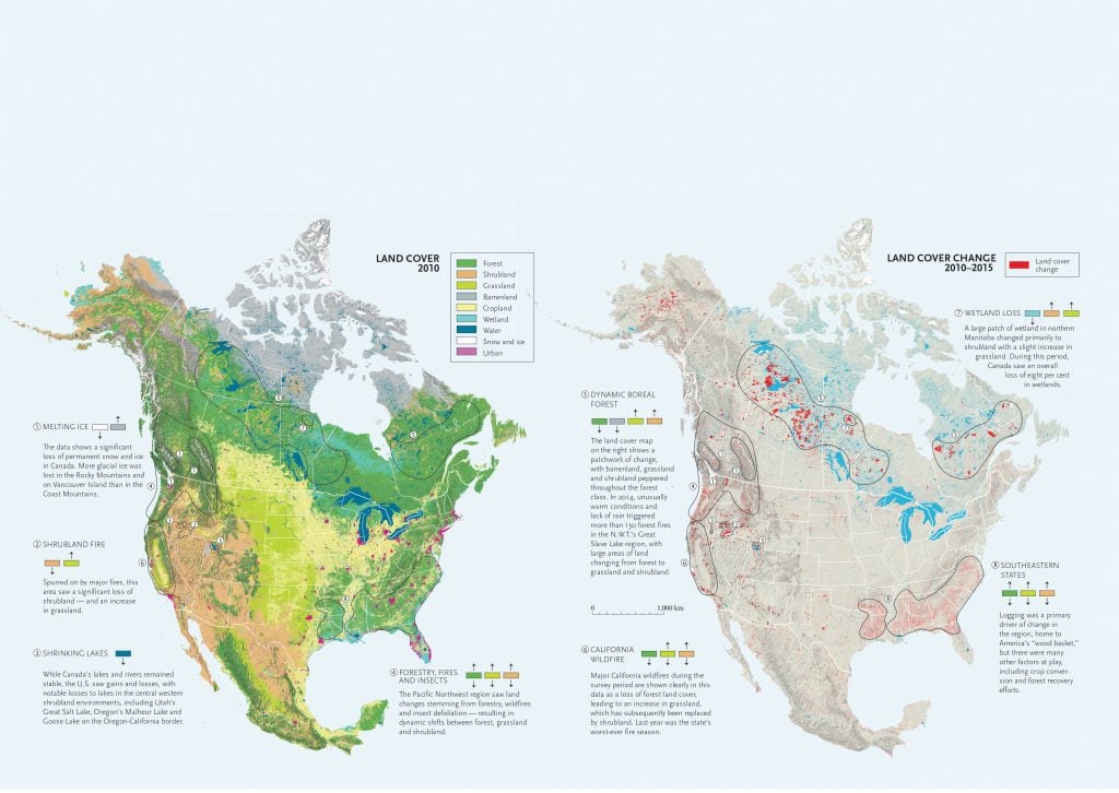
Land cover change maps can help us determine our impact on the land — and how we can mitigate it in the future
Mapping
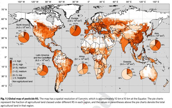
Asia and Europe revealed as having regions at high-risk of pesticide pollution
Mapping
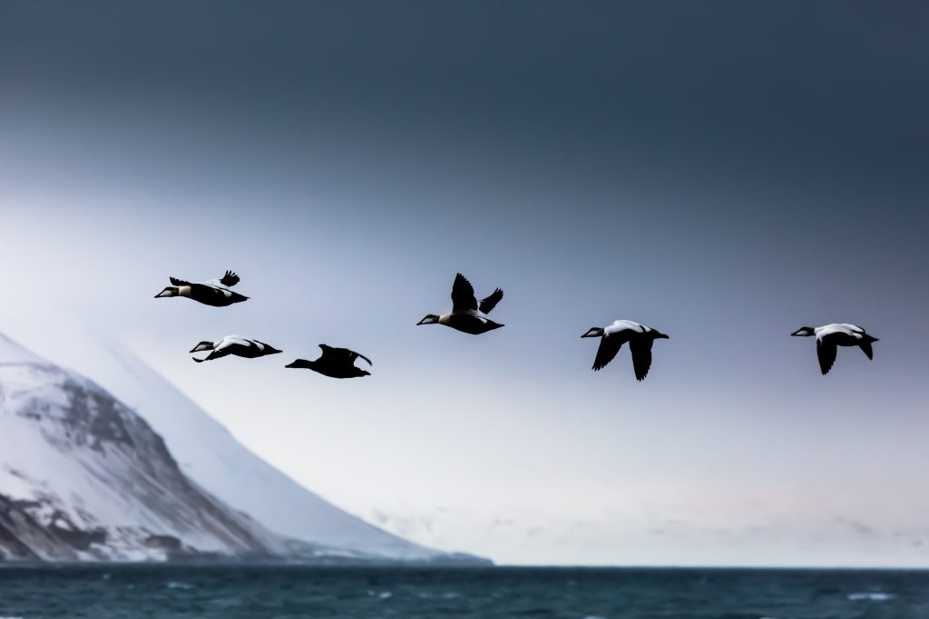
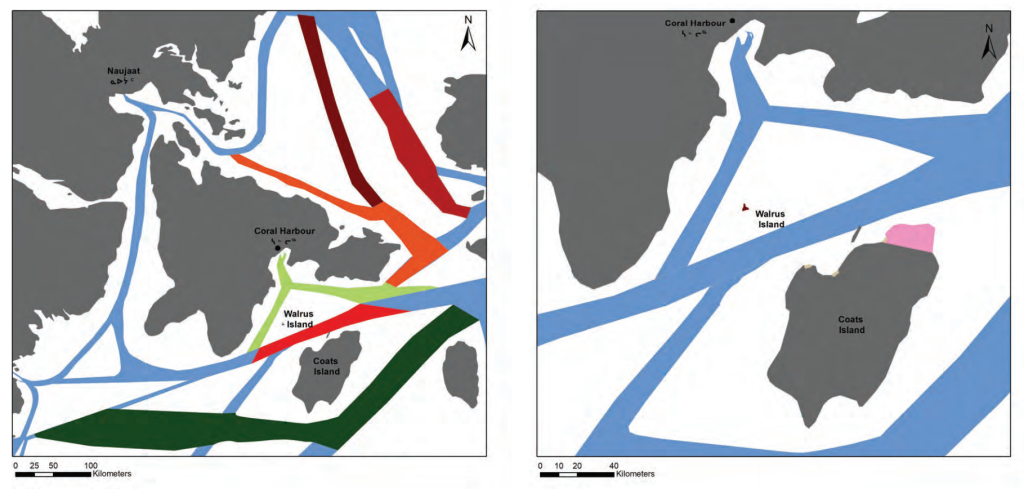
To wildlife disease ecologists, an ideal place to test ideas about herd immunity is Mitivik Island, Nunavut
Mapping
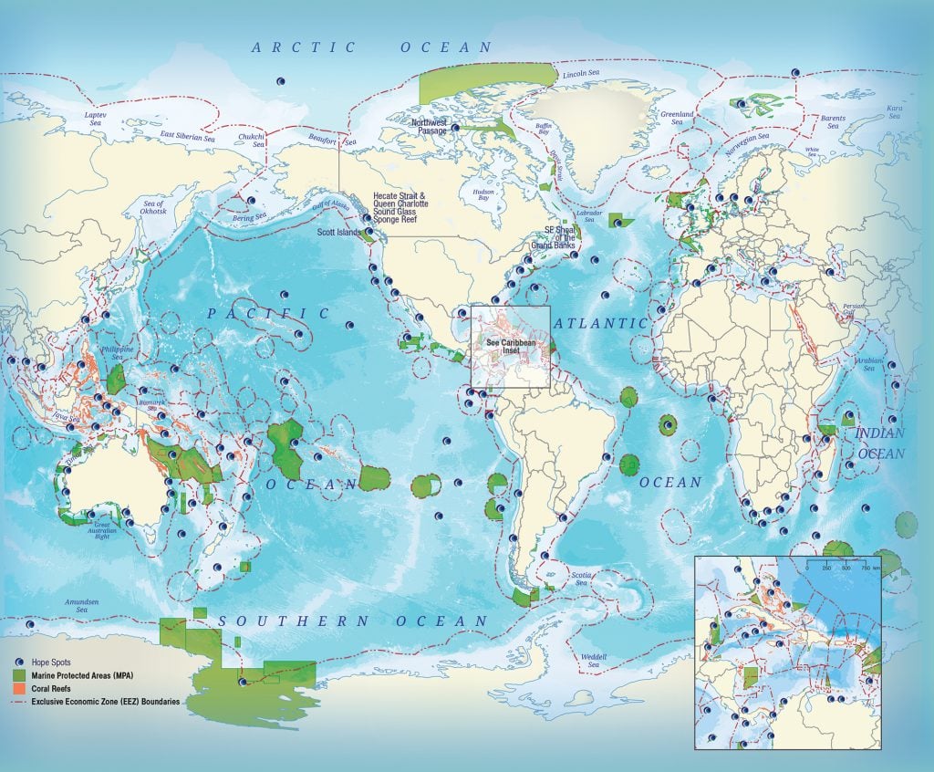
Charting “Hope Spots” critical to the health of our planet’s oceans
Mapping
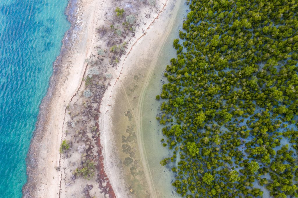
Mangroves provide a range of benefits, including protection from storms and the prevention of coastal erosion
Mapping
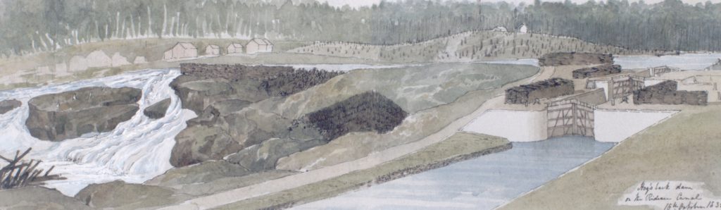
Construction of the crucial Hogs Back Dam on Ottawa's Rideau Canal almost thwarted engineers

Mapping
iPhone and Mac users across Canada will notice drastic changes to Apple Maps following a massive update pushed to devices yesterday

Mapping
Sewage testing can be used for early detection of disease
Mapping
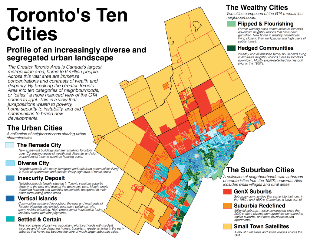
Urban geographer Liam McGuire on how he used maps to illustrate growing inequalities in Canadian cities

Mapping
Squalene, a compound found in shark liver oil, is a common ingredient used in vaccines to boost the body’s immune response
Mapping
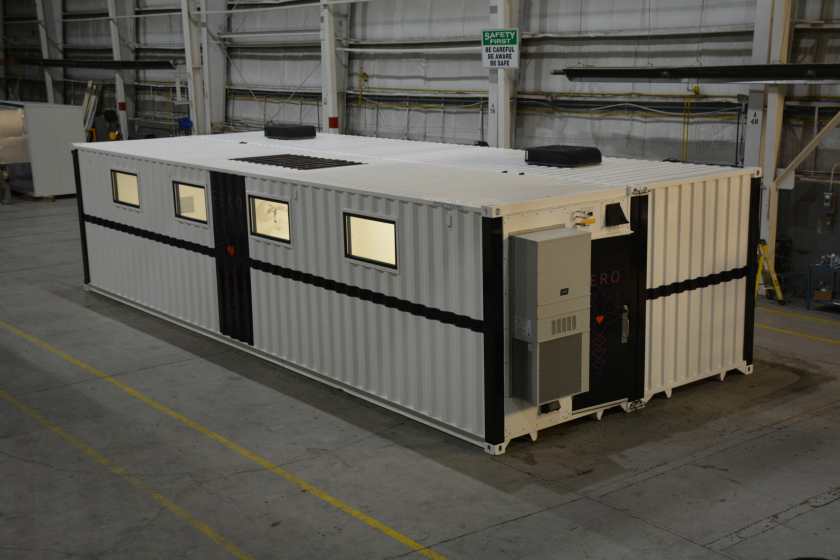
The portable hospital rooms made by Hamilton, Ont.-based company, Fero International, may aid in the frontline response to COVID-19
Mapping
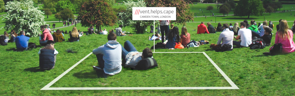
What3Words app gives 3m squares an identifying series of words, across the world
Mapping
Two Canadian researchers studied the studies to see if the science was sound
Mapping
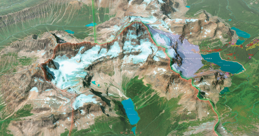
While its pyramid peak is almost instantly recognizable, Mount Assiniboine is also an excellent example of the general characteristics of all Canadian mountains

Mapping
Scientists are calling it the 'anthropause'
Mapping
Remote locations and international clientele make the industry particularly vulnerable
Mapping
Industrial engineer Cheryl White uses visual problem-solving and team engagement techniques in her day job. Now she’s using them to crowdsource a national mapping project.
Mapping
After years of work, the Sixties Scoop Network has launched their interactive mapping platform In our own Words: Mapping the Sixties Scoop Diaspora.

Mapping
Six urban planning experts share their views on municipal actions during COVID-19
Mapping
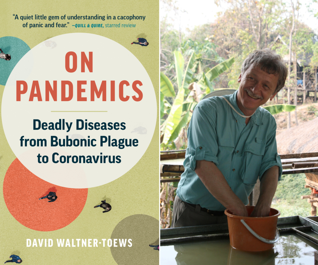
David Waltner-Toews speaks about his updated book On Pandemics: Deadly Diseases from Bubonic Plague to Coronavirus
Mapping
The slowdown of human activity as a result of the COVID-19 pandemic has led to some surprising benefits for wildlife conservation. Can we keep them going after the danger has passed?
Mapping
Animal care, public education continue to be top priorities in spite of major revenue losses
Mapping
Organizations say it’s too early to determine long-term effects

Mapping
Only about 50 per cent of asparagus crops will be harvested this year due to delays in migrant workers arriving
Mapping
Although much of the live festival programming has been cancelled due to the pandemic, flower fans will still be able to celebrate online
Mapping
The pandemic has already had a dramatic impact on the economy and environment, and may even offer clues as to how to more effectively address climate change

Mapping
Vaccines, treatments and virus mapping are all underway
Mapping
Changes were recommended for environmental and community benefits, ship safety
Mapping
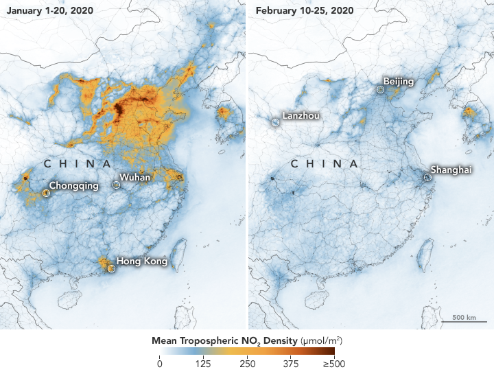
‘Maps aren't magic,’ says University of British Columbia prof — but during disease outbreaks, they can help us sort good information from bad
Mapping
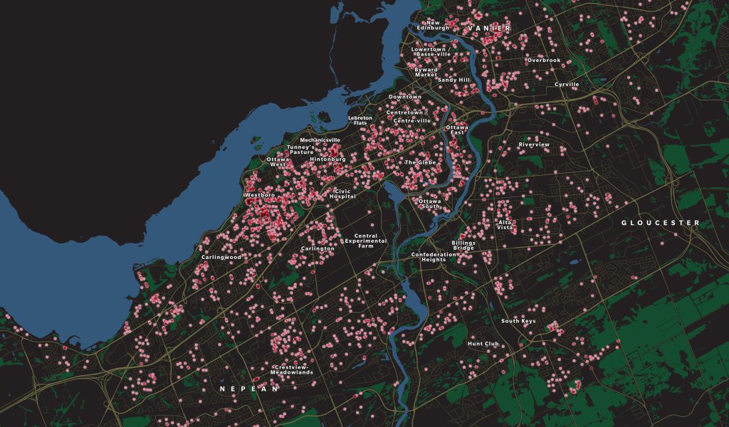
Thanks to machine learning, researchers have been able to monitor and map gentrification across the nation’s capital
Mapping
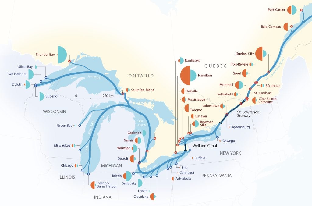
North America’s marine superhighway has weathered six decades of shifting international and domestic politics, trade breakdowns and new alliances, booms and recessions
Mapping
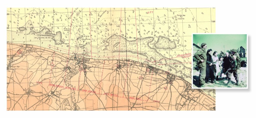
Marking the 75th anniversary of the Juno Beach landings
Mapping
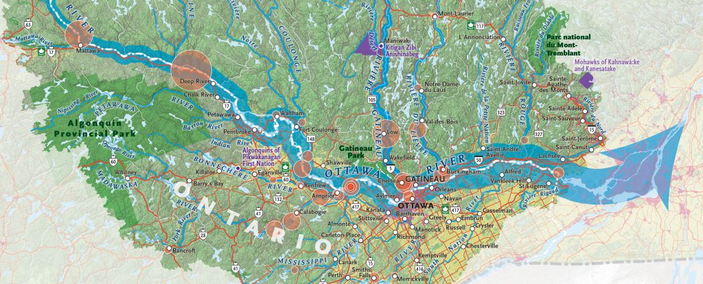
The Ottawa River is the heart of one of Canada’s most ecologically and economically important watersheds
Mapping
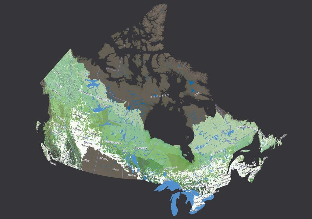
Species richness in Canada’s remaining intact forests
Mapping
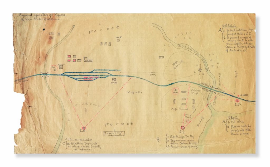
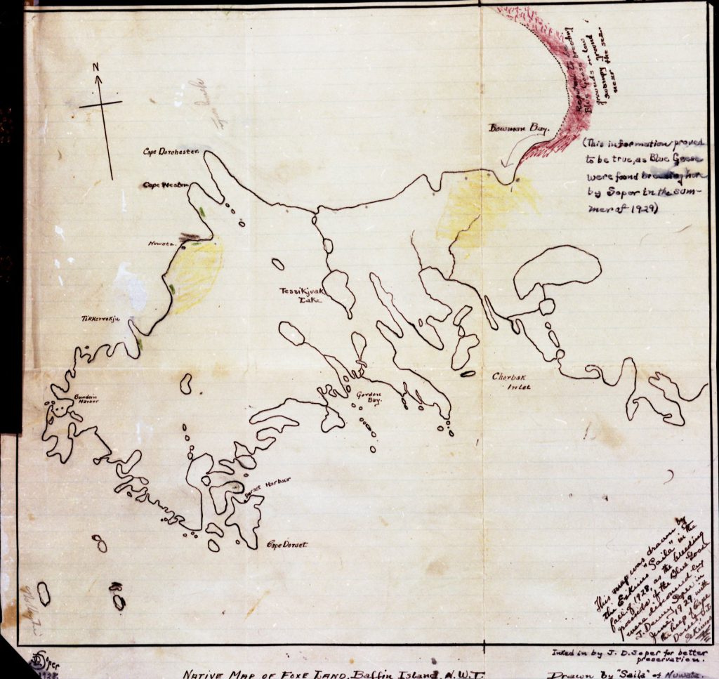
In 1929, J. Dewey Soper’s quest to find the breeding grounds of the blue goose ended, thanks in part to this marvelously detailed hand-drawn map
Mapping
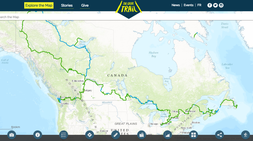
As Canada's most famous trail celebrates its near completion, Esri Canada president Alex Miller discusses the ambitious trail map that is helping Canadians get outdoors
Mapping
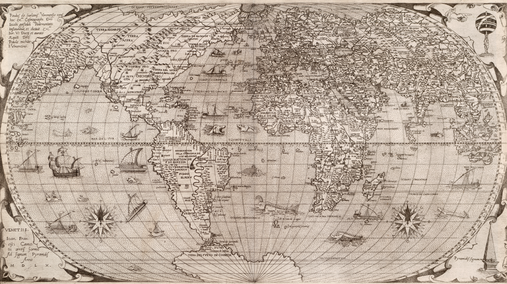
Chet Van Duzer, a cartographic historian and the author of Sea Monsters on Medieval and Renaissance Maps analyses Paolo Forlani's 1560 world map – the first known instance of the name "Canada" appearing on a printed map

Mapping
A new update allows users to view 3,100 Indigenous communities and treaty settlement lands
Mapping
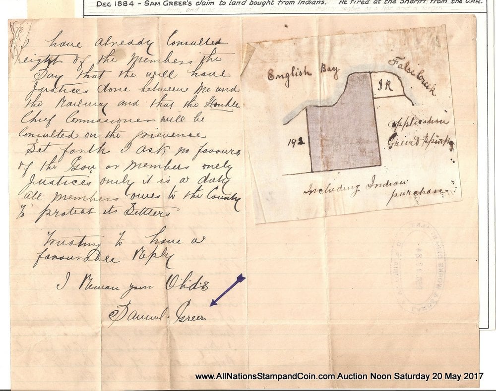
Brian Grant Duff from All Nations Stamp and Coin explains the controversial land claim made by Irish settler Sam Greer on what is today known as Kits Beach
Mapping
Information from Canada’s 2016 food safety report card shows the incidence of four illnesses